Cumulonimbus Cloud
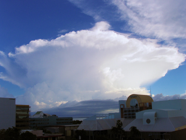
Cloud base is typically between 2,000 and 5,000ft, though in some cases this may be lower or higher. These clouds are formed when conditions are such that deep convection is able to develop, and may have a huge vertical extent particularly in the tropics, sometimes reaching the tropopause. These clouds produce heavy showers, thunderstorms and hail, often also producing squally winds. At lower levels these clouds consist of liquid drops, but as altitude increases the cloud progresses through mixed phase and fully glaciated conditions. A fully developed cumulonimbus cloud may have a classic anvil appearance as the upper levels of the cloud spread out on reaching the tropopause. These systems may produce a considerable amount of cirrus cloud as the anvil spreads out.