CSIP- Satellite Imagery.
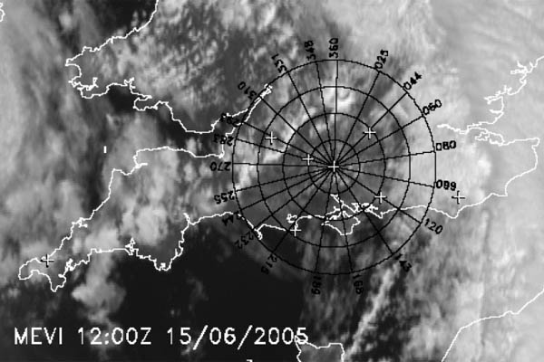
Typical example of the high-resolution satellite imagery that formed an essential part of the CSIP database, giving a clear indication in this instance of a convergence line, from Browning et al (2007).
This website will look much better in a web browser that supports web standards, but it is accessible to any browser or Internet device.